Please ensure Javascript is enabled for purposes of website accessibility

Technology

Technology for Uncovering What is Beneath the Surface

Technology has transformed how cultural resources can be located, evaluated, and documented — ACI realized this decades ago. We are a pioneer of predictive modeling, implementing the first recognized application of soil types to systemically locate and assess Florida’s cultural resources. Today, ACI combines 50 years of archaeological experience with GIS, GPS, LiDAR (Light Detection and Ranging), ground-penetrating radar (GPR), and other geophysical methods to gather precise information, identify resources, and develop careful strategies for investigation and preservation. 

How ACI Can Help

ACI integrates traditional investigation methods with innovative technology to provide clients with comprehensive archaeological services. Our geophysical staff has been trained through a variety of programs, and use these tools to evaluate archaeological potential prior to surveying, which helps develop efficient and cost-effective testing strategies. ACI can also map archaeological and historical features to support preservation and interpretation, while avoiding destruction through excavation, or identify the areas to excavate to ensure the best results possible are achieved.
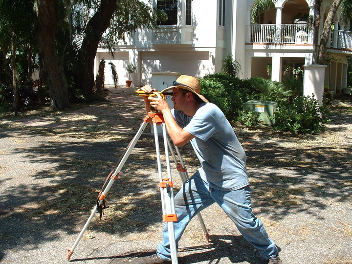
ACI-GIS-720 ACI-GIS-Winding Cypress 009-720 ACI-Using GPS unit Technology-1-1280 Technology-2-1280 Technology-3-1280

What Technology Services Include

ACI brings together geospatial analysis, predictive modeling, remote sensing, and high-accuracy data collection to build a more complete picture of what exists within a project area — and our staff has individually trained alongside experts in the technology we use on a variety of projects. Explore our core technology capabilities to learn how ACI can fulfill your project’s needs

Core Capabilities

The State's Leader in Innovating Site Location Strategies
For decades, ACI has led Florida in innovating site location strategies often focused on soils and other geological features. We are pioneers in the use of georeferenced data and modeling, and were one of the first firms to transition from using topographic paper maps and aerials to GIS/GPS applications in daily field operations. Technological advancements have allowed ACI to produce the high-quality data reports for our clients, meeting the highest standards of the Secretary of the Interior and State.
Archaeometry for a Variety or Projects
In recent years, ACI has rapidly expanded the use of archaeometry — the application of scientific methods and technology to archaeological study, and particularly, archaeogeophysics. Geophysical science explores the chemical and structural differences in soil that can be measured and averaged using specialized equipment. Measurements can focus on magnetism, electrical resistance, and differences in water saturation amongst other properties of earth, all with the goal of understanding what may be present below the ground without disturbing it. While these methods have been primarily used in geologic exploration and construction, they have also been successfully applied to archaeological sites.
LiDAR for Locating Features
ACI is at the forefront of utilizing LiDAR to analyze project areas for a variety of features, including cemeteries, mounds, wetlands, and land contours that have long been blunted by agriculture. Our staff is also ready to conduct high-definition GPR surveys to evaluate and address unforeseeable on-site issues such as the discovery of cultural resources, like cemeteries or isolated human remains.
Ground-penetrating radar (GPR)
ACI’s geophysical staff have received specialized training in GPR, including high- and low-frequency systems and data processing through GSSI, a recognized leader in GPR technology. Their training, combined with experience from experts in the field, allows ACI to use GPR effectively to investigate subsurface conditions, identify potential archaeological features, and inform preservation or excavation strategies.
Trained, Certified & Experienced Staff
Our staff has been trained and certified through a variety of programs, including the National Park Service's National Center for Preservation and Technology Training (NCPTT), GSSI, and ESRI — and industry leader in GIS software, mapping, and geospatial analysis. With years of experience using advanced technology on projects of all sizes, our clients can feel confident in the expertise they are being provided.
Immediate Data Returns
In the field, ACI deploys a technologically prepared team that can return data immediately to accommodate client needs. Field staff is equipped with high accuracy receivers that utilize the most recent mobile hardware for connectivity. As a member organization to ESRI ArcGIS Online and Enterprise, ACI can deploy quality historic imaging, KML, LiDAR, and shapefile information to provide clients comprehensive assessments of cultural resources and historic inventory analysis.
Deployment of Non-Destructive Techniques
To date, ACI has successfully used non-destructive techniques, like GPR and LiDAR, to locate and/or document a variety of archaeological sites, including forgotten or erased historic cemeteries, historic pauper cemeteries, the "lost" segregated parts of historic cemeteries, historic sawmill sites, and sites throughout the Everglades.

When to Contact ACI

Cultural Resources May Need to Be Located in Your Project Area

You need to understand what may be present beneath the surface before breaking ground — and we can help you determine whether technology-based investigation is appropriate for your project. If you have concerns regarding cultural resources and how technology can be deployed, the first step is starting a conversation with our team at ACI. 

From the First Conversation to a Clear Path Forward

Every project begins with understanding the entire situation. ACI reviews your project location, timeline, available documentation such as photos or descriptions of what was found, known requirements, and any concerns regarding cultural resources to determine the most appropriate path forward.

Your Details Help Us Determine the Scope

Using the information you provided, our team determines whether additional research, field investigations, technical studies, or other services are appropriate. We then develop a clear plan and provide the documentation or recommendations needed to support your project.

Need Technological Guidance for a Project or Property?

If you know technological expertise is what your project requires, or are unsure which services you need from ACI, we are always available to answer questions. Contact our team, tell us about your project, and we will place you on a clear path forward.